Endpoints
This page goes into the technical documentation of our API.
The Lizard REST API is used to interact with Lizard data and objects. The API enables to collect, export and manage data. With the API, objects and data can be listed, created, (partially) updated and retrieved. Objects and data have different endpoints, to allow specific interactions.
The endpoints are browseable through the API root view:
API V3 https://demo.lizard.net/api/v3/ (deprecated)
API V4 https://demo.lizard.net/api/v4/ (stable)
Resources are addressable via an URL and can be interacted with via HTTP verbs. The most commonly used and supported verbs are:
GET : retrieve data
PATCH/PUT : change data
DELETE : delete data
POST : add data
We also have HEAD and OPTIONS.
Authentication
When you login via your browser, your browser receives a session cookie. All subsequent requests to the API are authenticated with that session cookie.
Authenticating to the REST API outside of a browser is done by attaching a
Personal API Key to every request. You can attach a Personal API Key to
a request by using HTTP Basic Authentication with password = {your api key}.
The username needs to be fixed to __key__ (with double underscores on both
sides of the word “key”).
Almost all applications or script languages support HTTP Basic Authentication. See below for some examples.
Generate a Personal API key at https://demo.lizard.net/management/. It is considered best practise to generate one Personal API Key per application or script, so that you can selectively revoke keys in case they are compromised.
Examples
Python requests
With Python, we recommend using the requests package. Supply your API Key
in the auth parameter, as follows:
import requests

url = "demo.lizard.net/api/v4/locations"
my_secret_key = "abcdefg.01234567890"  # Example

response = requests.get(url, auth=("__key__", my_secret_key))
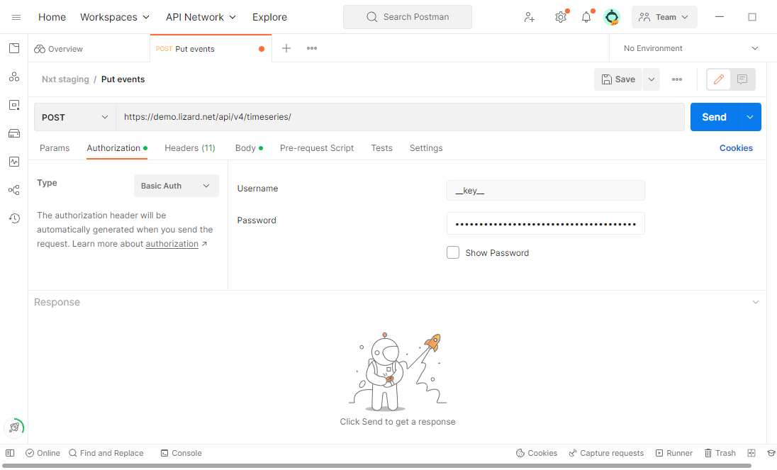
Postman
In Postman you can set up HTTP Basic Authentication as shown in the image below. Be sure to choose “Basic Auth” as Type, and not “API Key”.
Applications: OAuth2
Applications (such as dashboards) that use the Lizard API should authenticate using OAuth2. For this, you will need a registration. Contact our servicedesk to request one.
Legacy: username / password
Lizard supports authenticating by attaching username and password to
every request, either directly in Username and Password headers, or using
HTTP Basic Authentication. This legacy authentication does generate a session.
Warning
This form of authentication has been deprecated on June 1st, 2021. Ensure that your applications and scripts use new API Keys after that date.
In the period until June 1st, 2021, correct username / password combinations will be migrated automatically to a Personal API Key, in such a way that you may keep using the same username / password combination. Password changes will however not be reflected anymore in the migrated API Key.
Supported data formats
The data formats supported depend on the endpoint, although JSON is generally available. See documentation on the individual endpoints for specifics.
The format of responses can be controlled by specifying an Accept header
in requests, e.g. Accept: application/json. When posting data, the
format of the payload must be specified via a Content-Type header, e.g.
Content-Type: text/csv.
When interacting with the API via a browser, the format query parameter
may also be used for controlling the format of the response, for example:
Common variables
In this section, query parameters and response fields applicable to all endpoints are described.
Query parameters
The API supports the following common query parameters on GET list requests:
- GET /<endpoint>/?page=(int: offset)&page_size=(int: size)
- Query Parameters:
page – offset number; default is 0.
page_size – limit number of entries returned; default is 10.
Response fields
All list responses share the following fields.
count: number of results for this page
next: url to next page, null if last page
previous: url previous page, null if first page
results: array with actual results
These fields are not specifically mentioned in the response description of each endpoint.
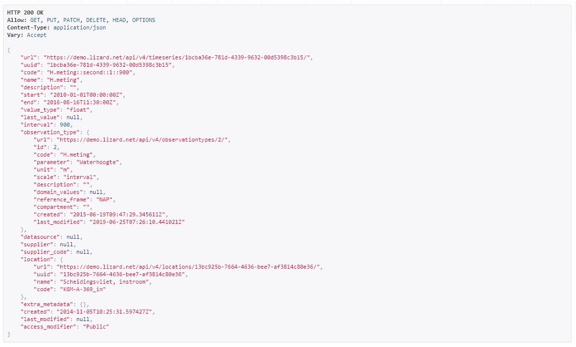
Timeseries
This section describes timeseries-related endpoints.
Example request:
Example response:
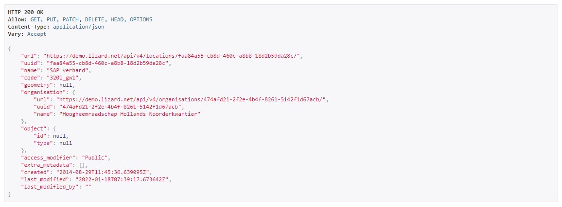
Locations
This section describes location-related endpoints.
Example request:
Example response:
Changes in v4 compared to v3
Some major changes have been made in the setup of API v4 in comparison to v3. We have worked on consistency in parameterisation and response formats per endpoint.
To help users convert their scripts and applications we list the most important changes here. For more details please inspect the documentation within the API.
Timeseries
Timeseries events, aggregates and percentiles can be retrieved from separate sub-endpoints under the timeseries instance, instead being combined in the detail page of the timeseries instance.
Timestamps are in ISO8601 format, instead of UNIX milliseconds.
Rasters
Raster aggregates have been split out in separate sub-endpoints under
/api/v4/rasters/{uuid}/:counts
curve
line
point
rrc
zonal
Raster WMS is no longer available within the versioned Lizard API (
/api/v3/wms/isn’t being replaced by/api/v4/wms/). Instead use https://demo.lizard.net/wms/.Timestamps are in ISO8601 format, instead of UNIX milliseconds.
Scenarios
scenario-results has become a sub-endpoint under scenario instances, i.e.
/api/v4/scenarios/{uuid}/results/
Labels
All label related endpoints have been grouped under the labeltypes endpoint.
Events
The events endpoint has been placed under eventseries.
Miscellaneous
/regions has become /boundaries in v4
The following endpoints will not return in v4:
annotations
domains
nodes
leveereferencepoints
leveerings
leveesections
leveezones
opticalfibers
timeseriestypes
Datatypes
Lizard can store & accelerate three types of data: vectors, rasters and time series. These data types are a digital representation of the physical environment. We also distinguish wms layers, scenarios and labels.
Rasters
Introduction
Rasters in Lizard represent continuous information about the physical environment across an area. Rasters can be static or temporal. Examples of static data are digital elevation models and land cover maps. Temporal raster datasets, or raster series, consist of a series of rasters for a certain time interval. Examples of temporal raster datasets are radar measurements of precipitation, air quality or hydrodynamic model results such as flood depths.
Why Rasterstores
The rasterstore is a library designed for quick data retrieval. Rasters provide a simple structure for data analyis.
Main functionalities:
Retrieve values for a specific location or area
Analyse data for a particular period or moment in time
Map visualisation in the lizard Viewer
Exporting to a geotiff file
Connecting with external applications via WMS
Base block for on-the-fly map calculations and conversions
API interactions: list, create, (partial) update, retrieve and delete
Raster data
A rasters is a grid of cells organized into rows and columns. Each cell contains a value that represents real-world phenomena, such as water depth. The values can be continuous (e.g. 28.5 degrees) or integer numbers. Integer numbers can represent classes (e.g. 1: Water, 2: Land).
Rasterstore data can be static or temporal. Examples of static data are a digital elevation model and a land cover map. Temporal rasterstores consist of multiple timesteps. The data can be stored in time using an origin (e.g. 2019-01-01) and an interval (e.g. every day). Examples are weather predictions and timeseries of 3Di model results.
Requirements
Your raster data has to be in the format of a single band, georeferenced TIFF (geotiff), with the following requirements:
Geotiff should have valid projection including transformation (EPSG code). All projections supported by proj4 are supported.
Geotiff should have a NODATA value.
Geotiff should be single band. RGB or multi-band is not supported.
Temporal raster datasets with multiple timesteps should be supplied with a single geotiff per timestamp
Raster metadata
Characteristics of rasters are stored in the attributes of a rasterstore. The attributes are used to indicate the function, purpose and meaning of data. The main attributes are listed below.
Organisation
Name
Description
Aggregation type
Observation type
Colormap
Supplier name
Supplier code
Temporal behaviour
Vectors
Vectors in Lizard represent physical or abstract objects in time and space. Lizard offers an extensive library of vector data models that can be used to represent objects (physical or abstract) in the physical environment. Per data model, there are columns defined with certain data_types. Some are obligatory, such as the id, some are optional. Below you find the available columns per data model.
column_name |
data_type |
|---|---|
id |
integer |
code |
character varying |
type |
smallint |
name |
character varying |
created |
timestamp with time zone |
geometry |
USER-DEFINED |
last_modified |
timestamp with time zone |
column_name |
data_type |
|---|---|
id |
integer |
organisation_id |
integer |
created |
timestamp with time zone |
code |
character varying |
name |
character varying |
type |
character varying |
width |
double precision |
length |
double precision |
height |
double precision |
image_url |
character varying |
geometry |
USER-DEFINED |
end |
timestamp with time zone |
start |
timestamp with time zone |
last_modified |
timestamp with time zone |
column_name |
data_type |
|---|---|
id |
integer |
created |
timestamp with time zone |
start |
timestamp with time zone |
end |
timestamp with time zone |
image_url |
character varying |
code |
character varying |
build_year |
integer |
geometry |
USER-DEFINED |
organisation_id |
integer |
last_modified |
timestamp with time zone |
column_name |
data_type |
|---|---|
id |
integer |
organisation_id |
integer |
created |
timestamp with time zone |
code |
character varying |
type |
character varying |
bed_level_upstream |
double precision |
bed_level_downstream |
double precision |
width |
double precision |
length |
double precision |
allowed_flow_direction |
integer |
height |
double precision |
material |
integer |
shape |
integer |
description |
text |
image_url |
character varying |
geometry |
USER-DEFINED |
end |
timestamp with time zone |
start |
timestamp with time zone |
num_timeseries |
integer |
last_modified |
timestamp with time zone |
column_name |
data_type |
|---|---|
id |
integer |
created |
timestamp with time zone |
filter_top_level |
double precision |
filter_bottom_level |
double precision |
aquifer_confiment |
text |
litology |
text |
code |
character varying |
groundwater_station_id |
integer |
top_level |
double precision |
high_groundwater_level |
double precision |
low_groundwater_level |
double precision |
last_modified |
timestamp with time zone |
column_name |
data_type |
|---|---|
id |
integer |
organisation_id |
integer |
created |
timestamp with time zone |
code |
character varying |
name |
character varying |
type |
integer |
water_level_summer |
double precision |
water_level_winter |
double precision |
water_level_fixed |
double precision |
image_url |
character varying |
geometry |
USER-DEFINED |
end |
timestamp with time zone |
start |
timestamp with time zone |
num_timeseries |
integer |
last_modified |
timestamp with time zone |
column_name |
data_type |
|---|---|
id |
integer |
organisation_id |
integer |
created |
timestamp with time zone |
image_url |
character varying |
code |
character varying |
name |
character varying |
surface_level |
double precision |
top_level |
double precision |
bottom_level |
double precision |
station_type |
integer |
geometry |
USER-DEFINED |
end |
timestamp with time zone |
start |
timestamp with time zone |
num_timeseries |
integer |
scale |
integer |
status |
integer |
last_modified |
timestamp with time zone |
column_name |
data_type |
|---|---|
id |
integer |
created |
timestamp with time zone |
start |
timestamp with time zone |
end |
timestamp with time zone |
image_url |
character varying |
code |
character varying |
name |
character varying |
distance_to_reference |
integer |
geometry |
USER-DEFINED |
levee_id |
integer |
organisation_id |
integer |
last_modified |
timestamp with time zone |
column_name |
data_type |
|---|---|
id |
integer |
organisation_id |
integer |
created |
timestamp with time zone |
code |
character varying |
recurrence_time |
integer |
material |
character varying |
coating |
character varying |
crest_height |
double precision |
image_url |
character varying |
name |
character varying |
category |
integer |
levee_ring_id |
integer |
levee_type |
integer |
geometry |
USER-DEFINED |
end |
timestamp with time zone |
start |
timestamp with time zone |
num_timeseries |
integer |
last_modified |
timestamp with time zone |
column_name |
data_type |
|---|---|
id |
integer |
organisation_id |
integer |
code |
character varying |
name |
character varying |
object_type_id |
integer |
object_id |
integer |
created |
timestamp with time zone |
access_modifier |
integer |
last_modified |
timestamp with time zone |
last_modified_by |
character varying |
extra_metadata |
text |
ddsc_icon_url |
character varying |
ddsc_show_on_map |
boolean |
geometry |
USER-DEFINED |
uuid |
uuid |
node_id |
integer |
supplier_id |
integer |
column_name |
data_type |
|---|---|
id |
integer |
organisation_id |
integer |
created |
timestamp with time zone |
code |
character varying |
surface_level |
double precision |
drainage_area |
integer |
material |
character varying |
width |
double precision |
length |
double precision |
shape |
character varying |
bottom_level |
double precision |
image_url |
character varying |
geometry |
USER-DEFINED |
end |
timestamp with time zone |
start |
timestamp with time zone |
num_timeseries |
integer |
water_consumption |
double precision |
last_modified |
timestamp with time zone |
column_name |
data_type |
|---|---|
id |
integer |
organisation_id |
integer |
created |
timestamp with time zone |
code |
character varying |
name |
character varying |
region |
character varying |
station_type |
integer |
category |
character varying |
frequency |
character varying |
image_url |
character varying |
geometry |
USER-DEFINED |
end |
timestamp with time zone |
start |
timestamp with time zone |
num_timeseries |
integer |
last_modified |
timestamp with time zone |
column_name |
data_type |
|---|---|
id |
integer |
created |
timestamp with time zone |
start |
timestamp with time zone |
end |
timestamp with time zone |
image_url |
character varying |
code |
character varying |
num_timeseries |
integer |
well_top_level |
double precision |
well_bottom_level |
double precision |
geometry |
USER-DEFINED |
levee_crosssection_id |
integer |
organisation_id |
integer |
last_modified |
timestamp with time zone |
column_name |
data_type |
|---|---|
id |
integer |
organisation_id |
integer |
created |
timestamp with time zone |
start_point_id |
integer |
end_point_id |
integer |
connection_serial |
integer |
crest_width |
double precision |
crest_level |
double precision |
shape |
character varying |
initial_opening_height |
double precision |
code |
character varying |
name |
character varying |
flow_type |
integer |
angle |
double precision |
contraction_coeff |
double precision |
lat_contr_coeff |
double precision |
negative_flow_limit |
double precision |
positive_flow_limit |
double precision |
allowed_flow_direction |
integer |
image_url |
character varying |
geometry |
USER-DEFINED |
end |
timestamp with time zone |
start |
timestamp with time zone |
last_modified |
timestamp with time zone |
column_name |
data_type |
|---|---|
id |
integer |
organisation_id |
integer |
created |
timestamp with time zone |
manhole_id |
integer |
connection_serial |
integer |
open_water_level_average |
double precision |
open_water_level_summer |
double precision |
open_water_level_winter |
double precision |
image_url |
character varying |
geometry |
USER-DEFINED |
end |
timestamp with time zone |
start |
timestamp with time zone |
last_modified |
timestamp with time zone |
column_name |
data_type |
|---|---|
id |
integer |
organisation_id |
integer |
created |
timestamp with time zone |
start_point_id |
integer |
end_point_id |
integer |
connection_serial |
integer |
crest_width |
double precision |
crest_level |
double precision |
open_water_level_average |
double precision |
open_water_level_summer |
double precision |
open_water_level_winter |
double precision |
angle |
double precision |
allowed_flow_direction |
integer |
image_url |
character varying |
code |
character varying |
geometry |
USER-DEFINED |
end |
timestamp with time zone |
start |
timestamp with time zone |
num_timeseries |
integer |
sensor_level |
double precision |
surface_level |
double precision |
name |
character varying |
last_modified |
timestamp with time zone |
column_name |
data_type |
|---|---|
id |
integer |
created |
timestamp with time zone |
start |
timestamp with time zone |
end |
timestamp with time zone |
image_url |
character varying |
code |
character varying |
name |
character varying |
external_id |
character varying |
geometry |
USER-DEFINED |
organisation_id |
integer |
num_timeseries |
integer |
last_modified |
timestamp with time zone |
column_name |
data_type |
|---|---|
id |
integer |
organisation_id |
integer |
created |
timestamp with time zone |
start_point_id |
integer |
end_point_id |
integer |
connection_serial |
integer |
invert_level_start_point |
double precision |
invert_level_end_point |
double precision |
length |
double precision |
type |
character varying |
material |
character varying |
width |
double precision |
height |
double precision |
shape |
character varying |
number_of_inhabitants |
integer |
dwa_definition |
character varying |
impervious_surfaces |
text |
allowed_flow_direction |
integer |
image_url |
character varying |
code |
character varying |
geometry |
USER-DEFINED |
end |
timestamp with time zone |
start |
timestamp with time zone |
last_modified |
timestamp with time zone |
column_name |
data_type |
|---|---|
id |
integer |
created |
timestamp with time zone |
image_url |
character varying |
code |
character varying |
name |
character varying |
organisation_id |
integer |
geometry |
USER-DEFINED |
end |
timestamp with time zone |
start |
timestamp with time zone |
last_modified |
timestamp with time zone |
column_name |
data_type |
|---|---|
id |
integer |
organisation_id |
integer |
created |
timestamp with time zone |
code |
character varying |
length |
double precision |
material |
character varying |
diameter |
double precision |
shape |
character varying |
year_of_construction |
integer |
image_url |
character varying |
type |
integer |
name |
character varying |
geometry |
USER-DEFINED |
end |
timestamp with time zone |
start |
timestamp with time zone |
last_modified |
timestamp with time zone |
column_name |
data_type |
|---|---|
id |
integer |
organisation_id |
integer |
created |
timestamp with time zone |
code |
character varying |
name |
character varying |
image_url |
character varying |
geometry |
USER-DEFINED |
end |
timestamp with time zone |
start |
timestamp with time zone |
connected_impervious_surface |
double precision |
downstream_pumped_drainage_area_id |
integer |
extraneous_water |
double precision |
inhabitants |
integer |
minimum_overflow_crest_level |
double precision |
pollution_equivalent |
double precision |
population_equivalent |
double precision |
pump_station_id |
integer |
sanitary_load |
double precision |
sewer_system |
integer |
upstream_load |
double precision |
water_consumption |
double precision |
water_retention_capacity |
double precision |
area_type |
integer |
connected_impervious_surface_mixed |
double precision |
connected_impervious_surface_rainwater |
double precision |
num_timeseries |
integer |
pump_overcapacity |
double precision |
last_modified |
timestamp with time zone |
column_name |
data_type |
|---|---|
id |
integer |
pump_station_id |
integer |
code |
character varying |
serial |
integer |
capacity |
double precision |
start_level |
double precision |
stop_level |
double precision |
name |
character varying |
type |
character varying |
reduction_factor_no_levels |
double precision |
reduction_factor |
double precision |
characteristics |
character varying |
allowed_flow_direction |
integer |
start_level_delivery_side |
double precision |
stop_level_delivery_side |
double precision |
created |
timestamp with time zone |
last_modified |
timestamp with time zone |
column_name |
data_type |
|---|---|
id |
integer |
organisation_id |
integer |
created |
timestamp with time zone |
code |
character varying |
type |
character varying |
start_point_id |
integer |
end_point_id |
integer |
connection_serial |
integer |
capacity |
double precision |
start_level |
double precision |
stop_level |
double precision |
name |
character varying |
allowed_flow_direction |
integer |
start_level_delivery_side |
double precision |
stop_level_delivery_side |
double precision |
image_url |
character varying |
geometry |
USER-DEFINED |
end |
timestamp with time zone |
start |
timestamp with time zone |
num_timeseries |
integer |
last_modified |
timestamp with time zone |
column_name |
data_type |
|---|---|
id |
integer |
created |
timestamp with time zone |
name |
character varying |
type |
integer |
use |
integer |
geometry |
USER-DEFINED |
code |
character varying |
end |
timestamp with time zone |
image_url |
character varying |
organisation_id |
integer |
start |
timestamp with time zone |
region_id |
integer |
last_modified |
timestamp with time zone |
column_name |
data_type |
|---|---|
id |
integer |
organisation_id |
integer |
created |
timestamp with time zone |
code |
character varying |
name |
character varying |
image_url |
character varying |
geometry |
USER-DEFINED |
end |
timestamp with time zone |
start |
timestamp with time zone |
num_timeseries |
integer |
last_modified |
timestamp with time zone |
column_name |
data_type |
|---|---|
id |
integer |
organisation_id |
integer |
created |
timestamp with time zone |
code |
character varying |
name |
character varying |
image_url |
character varying |
geometry |
USER-DEFINED |
end |
timestamp with time zone |
start |
timestamp with time zone |
num_timeseries |
integer |
last_modified |
timestamp with time zone |
column_name |
data_type |
|---|---|
id integer |
|
organisation_id |
integer |
created |
timestamp with time zone |
code |
character varying |
crest_type |
smallint |
crest_width |
double precision |
crest_level |
double precision |
name |
character varying |
lat_dis_coeff |
double precision |
angle |
double precision |
allowed_flow_direction |
integer |
controlled |
integer |
comment |
text |
discharge_coeff |
double precision |
image_url |
character varying |
geometry |
USER-DEFINED |
end |
timestamp with time zone |
start |
timestamp with time zone |
num_timeseries |
integer |
type |
smallint |
last_modified |
timestamp with time zone |
Time Series
Time series in Lizard represent in situ measurements and hindcasts/forecasts of processes in the physical environment.
A time series object is always related to a location object, which is in turn optionally linked to an asset. By clicking an asset in the Lizard Viewer a list of related time series objects is fetched which can be visualised.
The storage of time series data and the presentation in the API are focussed on high performance and retrieving relevant information out of it. There are multiple options for making aggregations and deriving statistics.
Value Types
Lizard time series can have different value types. The following value types are supported:
Numerical|Integer and float Alphanumerical|Text Images|PNG and JPG Files|E.g. PDF
Series of numerical values and images can be visualised in the Lizard Viewer. Text values and Files can only be retrieved or downloaded from the API.
Aggregation options
Time series can consist of many data points, making it difficult to handle when interested in longer periods of time. The Lizard API has several options to aggregate the bulk data to make it manageable for presentation in clients or for analysis purposes.
In the API there are two parameters that can be used for aggregating time series. First there is the window parameter to determine what is the interval of the retrieved (aggregated) data. Options are:
raw
5min
hour
day
week
month
year
Field parameters
The timeseries events sub-endpoint returns the raw values. It is also possible to retrieve aggregated values, in the aggregates sub-endpoint. With the fields parameter many statistics can be retrieved. Multiple fields can be requested in one call.
Options are:
min
min_timestamp
max
max_timestamp
avg
count
first
first_timestamp
last
last_timestamp
nans
sum
For more options in requesting time series see the API endpoint: https://demo.lizard.net/api/v4/timeseries/{timeseries_uuid}/aggregates/
Labels
Labels consist of three elements that are available through our API: LabelTypes, Labels and LabelParameters. Labels are always linked to an organisation. Each element is explained below.
LabelTypes
LabelTypes can be found on the LabelType-endpoint https://demo.lizard.net/api/v4/labeltypes and describe the type of Label. LabelTypes contain the following fields:
name: name of the LabelType
description: description of the LabelType
uuid: unique ID for the LabelType
organisation: organisation that owns the LabelType
created: date when LabelType was created
object_type: the type of Asset related to the LabelType
last_modified: date when LabelType was last updated
source: source of the LabelType e.g. a GeoBlock
Labels
The Labels related to a specific LabelType can be found on the Labels-endpoint demo.lizard.net/api/v4/labeltypes/{labeltype_uuid}/labels. Labels contain the follow fields:
label_value: the index value of the Label
object_type: the type of Asset related to the Label
object_id: id of the Asset
created: date when the label was created
start: start of the validity of the Label (history of the Label)
end: end of the validity of the Label (history of the Label)
extra: this field can be used to show variables related to the definition of the Label (for instance a threshold value related to the Label)
LabelParameters
The Label parameters is developed to store parameters that are used in the computation of the Label. LabelParameters are linked to LabelTypes and Assets and can be found on the LabelParameters-endpoint demo.lizard.net/api/v4/labeltypes/{labeltype_uuid}/labelparameters. LabelParameters contain the following fields:
label_type: the related LabelType
value: value of the parameters
name: name of the parameter
object_type: the type of Asset related to the LabelParameter
object_id: the ID of the Asset related to the LabelParameter
created: date when LabelParameter was created
start: start of the validity of the LabelParameter (history of the LabelParameter)
end: end of the validity of the LabelParameter (history of the LabelParameter)
Label statistics
With the count filter on the Labels endpoint it is possible to query a histogram of all Labels of a certain LabelType or a histogram of Labels within a region (e.g. municipality).